...
Available Smart City Real Time Data Endpoints
FIWARE offers a huge amount of Open Data that is available for you for free at https://data.lab.fiware.org. This section covers the most important real-time information that you will be able to find in all the cities that participates in the FIWARE initiative.
Santander (Spain)
The city of Santander in Spain, relies on FIWARE for publishing its smart city real time data. For this purpose, the city has two different NGSI endpoints using NGSI v1 and NGSI v2 respectively.
The There is one NGSI v1 service is deployed on http://mu.tlmat.unican.es:8099/ and queried using can be queried sending NGSI queries to the queyContext service using HTTP POST requests. Thise This service responses with a contextResponses node containing a list of contextElement, each representing a entitity or sensor. For these entities, it is included the type, the id, and a list of attributes, which is different depending on the type of the entities.
...
- Indoor parkings: Real time information of existing indoor parkings and the number of available spots. In the following screenshot you can find an example of the information returned for an indoor parking:
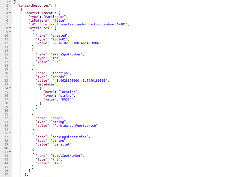
- As can be seen in the screeshot, ParkingLot entities contain the following attributes:
- created: The creation date in ISO8601 format
- extraSpotNumber: An integuer integer with the number of available spots for parking
- location: Coordinates of the parking in WGS84 format
- name: Name of the parking
- parkingDisposition: Disposition of the cars in the parking, e.g parallel
- totalSpotNumber: An integuer integer with the total number of parking spots
- As can be seen in the screeshot, ParkingLot entities contain the following attributes:
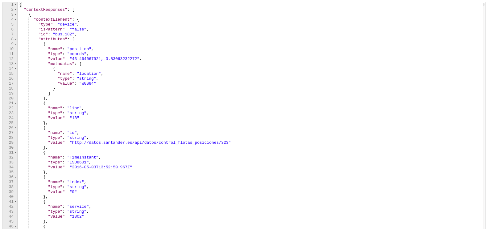
- Ambient data: Retrieved Real time information of ambient data, retrieved from sensors deployed in city buses, it includes its location, speed, altitude, and pollutants (CO, NO2, O3). The following screenshot shows the information available for these sensors:
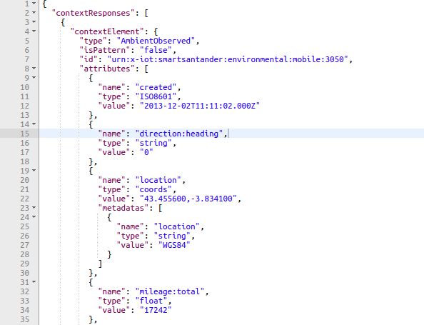
- As can be seen in the screenshot, AmbientObserved entities contain the following attributes:
- created: The creation date in ISO8601 format
- direction:heading: Direction of the bus (in degrees) where the sensor is deployed
- location: Coordinates of the sensor in WGS84 format
- mileage:total: Total distance covered by the bus where the sensor is deployed
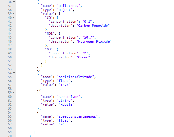
- pollutants: Current values of CO, NO2 and O3
- position:altitude: Current altitude (meters) of the bus where the sensor is deployed
- sensorType: Type of the sensor
- speed:instantaneous: Current speed (km/h) of the bus where the sensor is deployed
- Additionally, some of the sensors include two extra attributes:
- As can be seen in the screenshot, AmbientObserved entities contain the following attributes:


- relativeHumidity: % of relative humidity
- temperature: Temperature in ºC
- Ambient Areas: It includes a Geo poligon Geopolygon describing the different ambient areasStreet Parkings: Including the allowed vehicles (e.g car), the total number of spots, the available spots, and its location
, as can be seen in the following screenshot: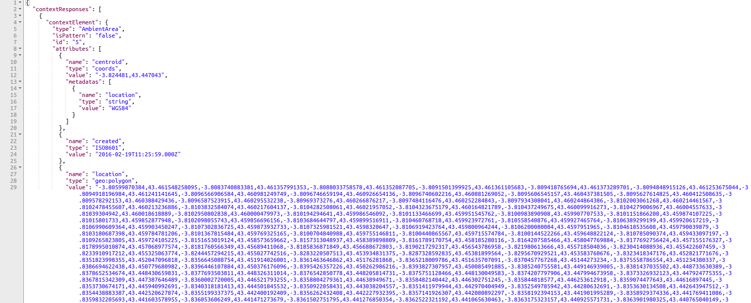
- As can be seen in the screenshot, AmbientArea entities contain the following attributes:
- created: The creation date in ISO8601 format
- centroid: Coordinates of the geo poligon centroid in WGS84 format
- location: Coordinates of the different points that build up the geo poligon in in WGS84
- As can be seen in the screenshot, AmbientArea entities contain the following attributes:
There is also another NGSI v1 deployed on http://130.206.85.12:1026 that offers information about the different buses on service in Santander:
- Buses: Real time information about the different buses on service in the city of Santander. The following screenshot shows the data returned from these sensors:
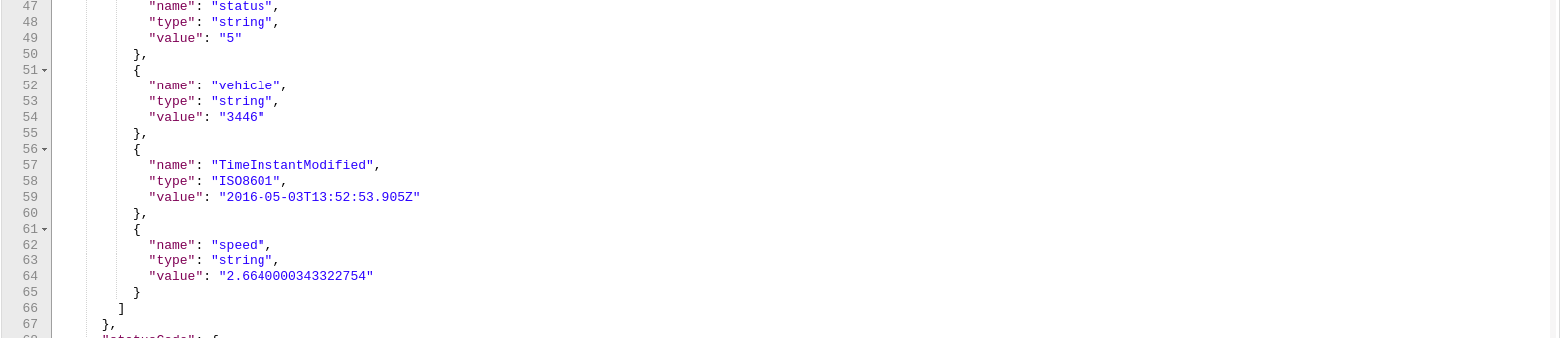
- As can be seen, the following attributes are returned:
- position: The current position of the bus
- line: The bus line covered by the given bus
- TimeInstant: Relates to the time when the information was extracted
- vehicle: The number that identifies the bus
- speed: The current speed of the bus
- As can be seen, the following attributes are returned:
Additionally, the NGSI v1 Global Instance deployed on the FIWARE Lab (http://orion.lab.fiware.org:1026) offers some real time information of Santander. Please, take note that to access these data, you have to have a FIWARE Lab account. You can create a new one at: https://account.lab.fiware.org/sign_up/. The information provided by this endpoint covers:
- Mobile Sensors: Real time information of ambient data, retrieved from sensors deployed in mobile vehicles (public transport, taxis, police cars,...) in Santander. The following screenshot shows the data returned from these sensors:

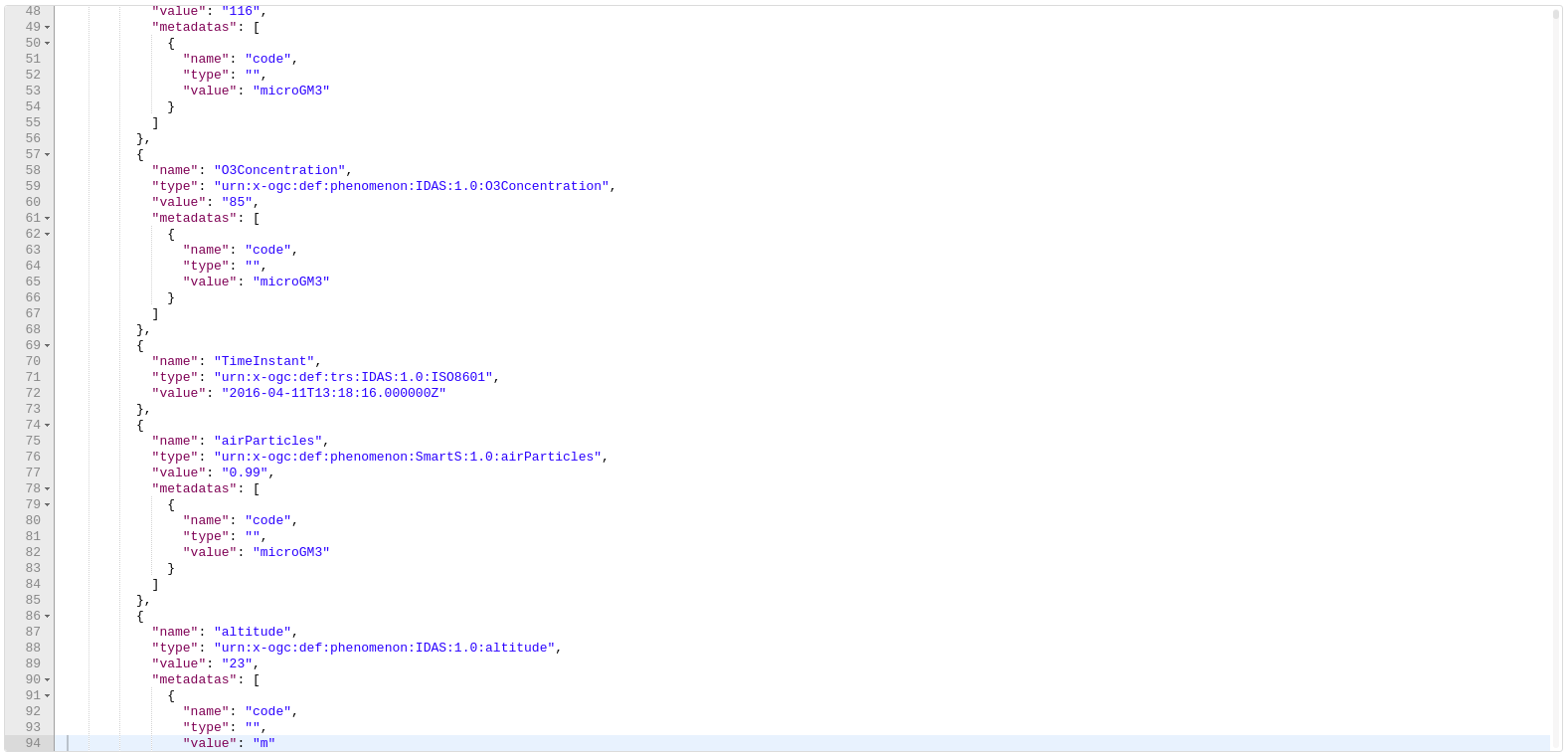

- The attributes returned for each entity are:
- COConcentration: Concentration of CO registered by the sensor
- Latitud: The latitude where the measure were taken
- Longitud: The longitude where the measure were taken
- NO2Concentration: Concentration of NO2 registered by the sensor
- O3Concentration: Concentration of O3 registered by the sensor
- TimeInstant: Relates to the time when the information was extracted
- airParticles: The number of particles in the air registered by the sensor
- altitude: The altitude where the measure were taken
- odometer: The number of kms that the sensor has covered until now
- relativeHumidity: % of relative humidity
- temperature: Temperature in ºC
- The attributes returned for each entity are:
- Sound Sensors: Sound monitoring entities that show information about the sound level, time instant, battery charge and geolocation. The sound level measured is provided by the sound field. The following screenshot shows the data returned from these sensors:
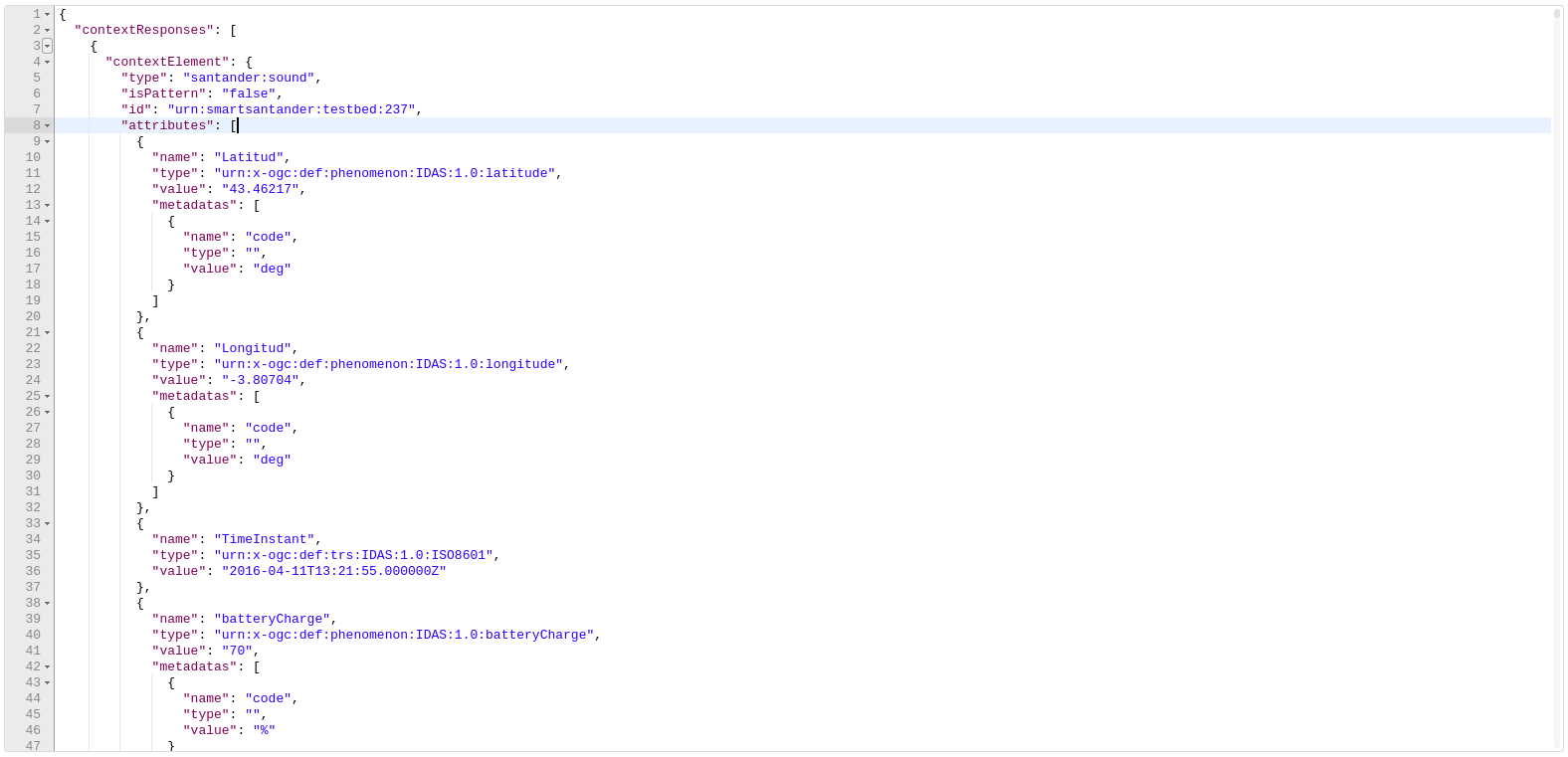
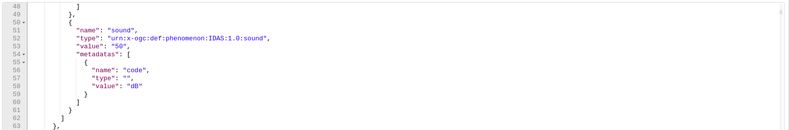
- The attributes returned for each entity are:
- Latitud: The latitude where the measure were taken
- Longitud: The longitude where the measure were taken
- TimeInstant: Relates to the time when the information was extracted
- batteryCharge: The level of battery of the given sensor
- altitude: The altitude where the measure were taken.
- sound: The current level of sound (given in dB) registered by the sensor
- The attributes returned for each entity are:
Last but not least, there is a NGSI v2 endpoint deployed on http://130.206.83.68:1026 and can be queried with simple HTTP GET requests. This service responses with a list of entities containing an id, a type and a set of attributes. This endpoint contains the following information:
- Street Parking Lots: Real time information of street parking lots retrieved from some sensors deployed on the street. The following screenshot shows the data returned from these sensors:
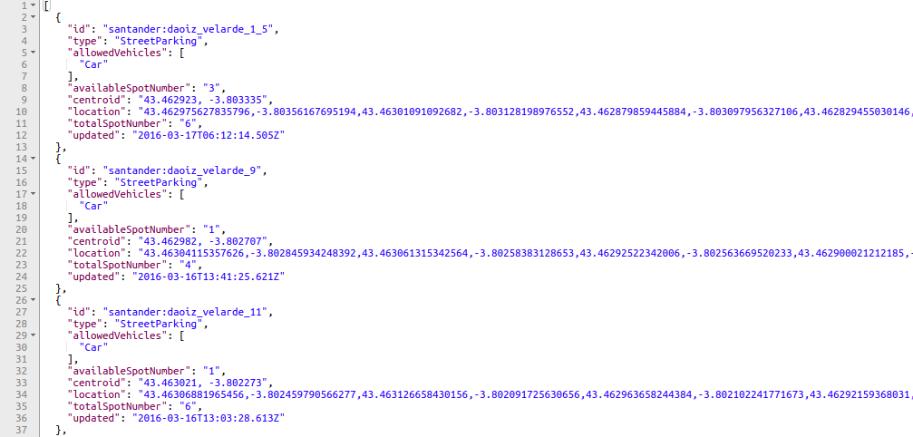
- As can be seen in the screenshot, StreetParking entities contain the following attributes:
- allowedVehicles: Type of vehicles that can park in the available spots
- availableSpotNumber: Number of available spots for parking
- location: Coordinates of the different points that build up the geo poligon which demarcate the parking area in WGS84 format
- centroid: Coordinates of the geo poligon centroid in WGS84 format
- totalSpotNumber: Total number of spots for parking
- updated: The last update date in ISO8601 format
- As can be seen in the screenshot, StreetParking entities contain the following attributes:
You can find the endpoints and examples on how to query Santander Sensors in the Santander Sensors Postman
Porto (Portugal)
The city of Portugal makes use of FIWARE technology to provide citizens real time information. This information is provided through three different NGSI instances.
There is one NGSI v2 instance deployed on http://130.206.83.68:1026 that provides information of the different Ambient Areas in which the city of Porto is divided:
- Ambient Zones: The different ambient zones in which the city of Porto is divided. The following screenshot shows the data returned:
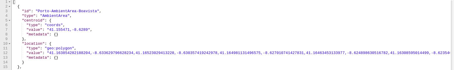
- Each entity contains one of the different ambient zones of Porto. For each entity, the following attributes are returned:
- centroid: The center of the polygon
- location: Coordinates of the different points that build up the geo poligon in in WGS84
- Each entity contains one of the different ambient zones of Porto. For each entity, the following attributes are returned:
There is NGSI v1 instance deployed on http://fiware-porto.citibrain.com:1026 that provides the following entities:
- Environmental Events: Environmental measures across the city of Porto. The following screenshot shows the data returned from those sensors:
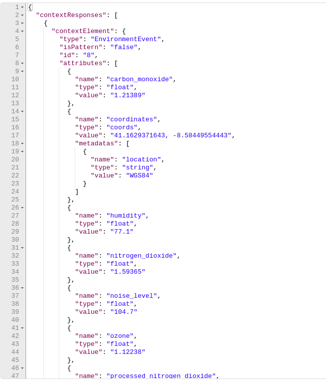
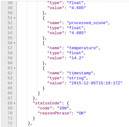
- Each entity contains the information provided by one sensor deployed on the city of Porto. The following attributes are returned:
- carbon_monoxide: The amount of CO registered by the sensor
- coordinates: The position of the sensor
- humidity: % of relative humidity
- nitrogen_dioxide: The amount of NO2 registered by the sensor
- noise_level: The amount of noise registered by the sensor
- ozone: The amount of O3 registered by the sensor
- processed_nitrogen_dioxide: The amount of processed NO2 registered by the sensor
- processed_ozone: The amount of processed O3 registered by the sensor
- temperature: The temperature in ºC registered by the sensor
- timestamp: The time when the measures were taken
- Each entity contains the information provided by one sensor deployed on the city of Porto. The following attributes are returned:
- Traffic Events: Traffic information about the city of Porto extracted from mobile sensors. The following screenshot shows the data returned by these sensors:

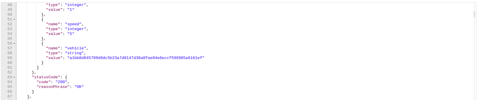
- Each entity contains information about one traffic sensor that contains the following attributes:
- coordinates: The current position of the sensor
- date: The date when the information of the sensor was updated
- distance: The distance covered by the sensor
- hdop: The precision of the geographical information returned by the sensor GPS
- latitude: The current latitude where the sensor is located
- longitude: The current longitude where the sensor is located
- movement: 1 if the sensor is in movement
- speed: The current speed of the sensor
- vehicle: The ID of the vehicle
- Each entity contains information about one traffic sensor that contains the following attributes:
Finally, there is another NGSI v1 endpoint deployed on https://api.ost.pt/ngsi10/contextEntityTypes that provides information about garages (category 9), gas stations (category 417) and parking lots (category 418). The following screenshot shows the data returned from these sensors:

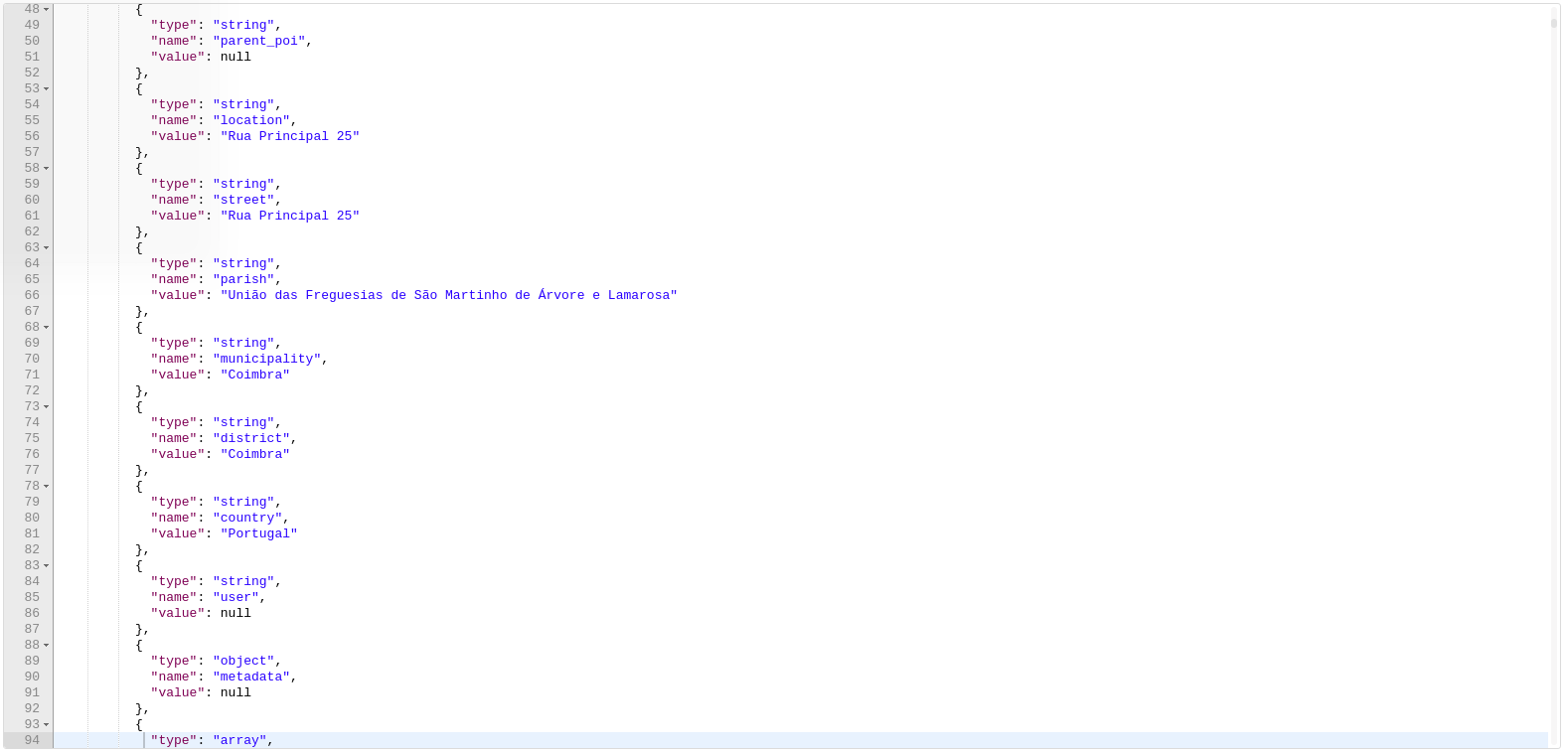
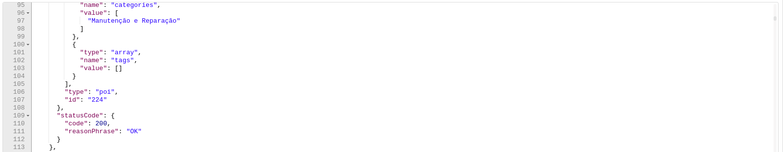
As can be seen in the screenshot, POIs entities contain the following attributes:
- name: The name of the POI
- geom_feature: The coordinates where the POI is located
- last_modified: The last time when the information of the POI was updated
- start_time: The first time when the system retrieved information from that POI
- end_time: The expected time when the POI is not going to be updated any more
- parent_poi: The ID of the parent POI
- location: Textual information about the POI position
- street: The name of the street where the POI is located
- parish: The name of the parish where the POI is located
- municipality: The name of the city where the POI is located
- district: The name of the district where the POI is located
- country: The name of the country where the POI is located
- metadata: Extra information about the POI
- categories: The categories the POI belongs to
- tags: A set of tags to categorize the POI
You can find the endpoints and examples on how to query Oporto Sensors in the Oporto Sensors Postman
Valencia (Spain)
The city of Valencia does not provide its data in NGSI format yet. However, it relies on FIWARE technology to offer real time information in other formats such as GeoJSON. Concretely, you can access to the following real-time information about:
- ValenBisi: The system of bike renting provided by the city. The following screenshot shows the data returned from these sensors:
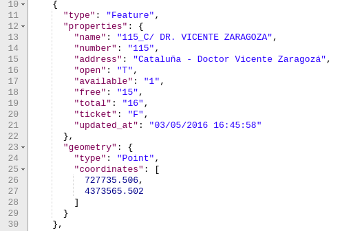
- As can be seen in the screenshot, each feature relates to one bike rental station and the following properties are attached:
- name: The name of the station
- number: The number of the street where the station is located
- address: The name of the street where the station is located
- open: "T" if the station is open, "F" otherwise
- available: The number of bikes available
- free: The number of free bike terminals
- total: The total number of bike terminals
- ticket: "T" if payment with credit card is allowed, "F" otherwise
- updated_at: the time when the information was updated
- As can be seen in the screenshot, each feature relates to one bike rental station and the following properties are attached:
- Traffic: Traffic information if real time in segments. The following screenshot shows the data returned from these sensors:
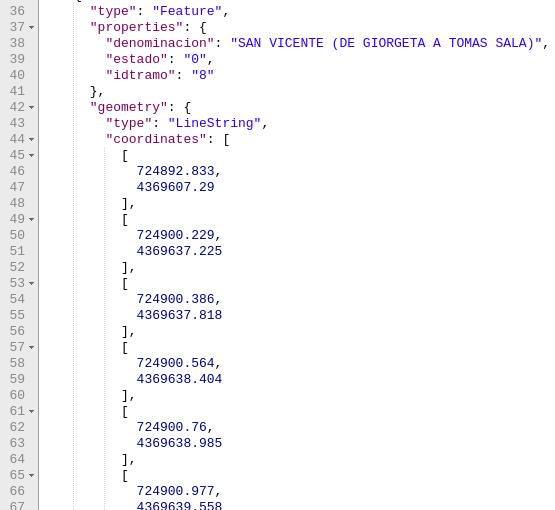
- As can be seen, each segment contains a "estado" field that represents the state of the segment:
- 0: Fluid
- 1: Heavy
- 2: Congested
- 3: Closed
- As can be seen, each segment contains a "estado" field that represents the state of the segment:
You can find the endpoints and examples on how to query Valencia Sensors in the Valencia Sensors Postman